Louisiana's Position on the United States Atlantic & Gulf of Mexico Coastal Plain
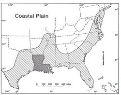
From Yodis et al, 2003.
Location of the Coast in What is Now the United States Over the Last 72 Million Years
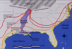
From Richard Campanella.
Official Map of Louisiana - 1990s and before (Department of Transportation and Development)
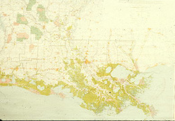
The official map of Louisiana that was sold by the state throughout the 1970s-1990s. It was never adjusted for coastal wetland loss. Compare this to the new map (below) adopted in 2000.
Official Map of Louisiana - 2000 to now (Department of Transportation and Development)
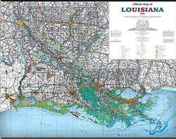
The official Louisiana map dated 2000. Note how different the coast looks compared the the long standing official map (above) that was still sold by the State throughout the 1990s.
Vegetation zones of Louisiana.
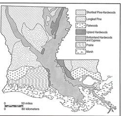
For the naturalist, these descriptive zones, defined by their dominant vegetation types, help define the differences in biodiversity and species composition in different areas. From Yodis et al., 2003.
Louisiana Ecoregions - 2008 -
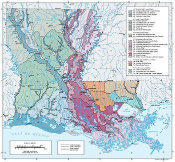
Click Here To Access The Ecoregions Map. PRINCIPAL AUTHORS: Jerry J. Daigle (NRCS), Glenn E. Griffith (Dynamac Corporation), James M. Omernik (USGS), Patricia L. Faulkner (LNHP-LDWF), Richard P. McCulloh (LGS), Lawrence R. Handley (USGS-National Wetlands Research Center [NWRC]), Latimore M. Smith (The Nature Conservancy), and Shannen S. Chapman (Dynamac Corporation).
Louisiana Ecoregions
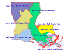
These descriptions work, but naturalists most often use the terms used in the map above.
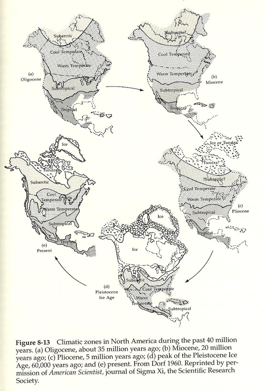
Climatic Zones of North America During the Last 40 Million Years
Drainage basins of Louisiana
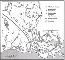
This map shows the drainage basins in Louisiana. In New Orleans, we are most aware of the Pontchartrain Drainage Basin due to the excellent work of the Lake Pontchartrain Basin Foundation. From Yodis et al., 2003.
Physiographic Map of Louisiana
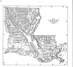
Louisiana has a simplistic physiographic history as compared to, say, Colorado or Texas. This map is simplified below. From Yodis et al., 2003.
For more information, click this link.
For more information, click this link.
Simplified Physiographic Map of Louisiana
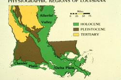
The more complicated physiographic map of Louisiana above is summarized here to show the older (Tertiary) land, then that from the Ice Age (Pleistocene), and the recent (Holocene).
Regional names for sections of Louisiana
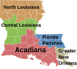
These terms are frequently used by naturalists and other for general regions fo the state. "Florida Parishes" is used because that region used to be part of Florida. It is very interesting biologically because it is part of a continuum that extends to the Atlantic coast, and there are many species of plants and animals whose entire range in Louisiana is in this area.
Map of Gulf Intracoastal Waterway (GIWW) & other Human-made Navigation Canals

This map has the waterways superimposed on a Louisiana Department of Wildlife & Fisheries 1978 coastal map that illustrates to location of the four types of coastal marshes: saline, brackish, intermediate, and freshwater.
Coastal Wetland Changes 1932-2050
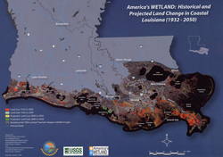
This map is by the America's WETLAND Campaign. It shows what vegetated wetland was lost or is projected to be lost during what year spans over an approximate 120 year period.
For a summary of changes between 1956-2006, click here.
For a summary of changes between 1956-2006, click here.
Mississippi River water at flood stage - May 11
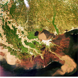
The Mississippi River in flood stage in May, 2011. Note the plume of typically tan (due to clays) river water entering the Gulf of Mexico at the mouth of the river and at the Atchafalaya River to the west. Also, note the similar plume entering Lake Pontchartrain through the totally open Bonnet Carre Spillway.
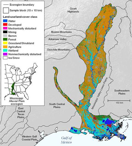
Mississippi River Alluvial Plain Ecoregions - 1992 - by Kristi Sayler, USGS
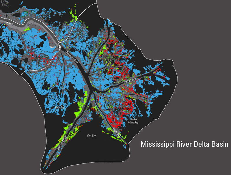
Balize Subdelta of the Mississippi River Delta - 2006 - Gaye Farris & John Barras for NASA
